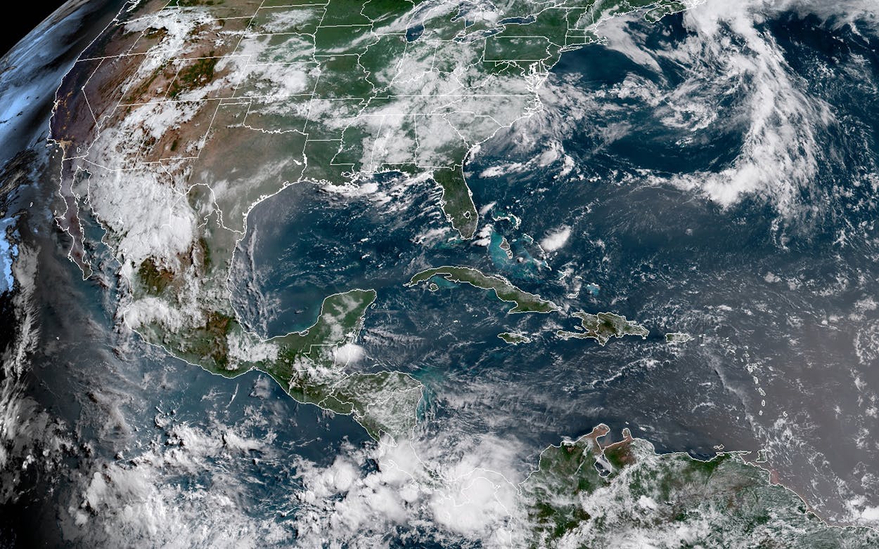
You may have noticed the big Texas sky looks a little opaque this week. That’s because of a visiting cloud of dust from the Saharan Desert that blew over the Atlantic about a week ago to settle over the Gulf Coast. While the African dust outbreak—the second to visit Texas this year—may seem like an anomaly, they’ve been occurring for hundreds, if not thousands, of years.
The traveling dust outbreaks, called the Saharan Air Layer by scientists, typically occur during the summer season and are a result of storms in the Sahel region of Africa. “During this time of year, we start getting these ripples in the atmosphere, these tropical waves start to kick off. And some of those waves, and the storms that they create, can actually kick off these dust storms,” says Jason Dunion, a meteorologist at the University of Miami and the National Oceanic and Atmospheric Administration’s Hurricane Research Division. “They start pushing wind up into the Sahara that lifts that desert dust off the surface and then it gets carried thousands of miles. So it’s really the weather patterns just south of the Sahara, over the Sahel, that are helping to kick off these huge dust outbreak events.”
This particular dust outbreak left the African coast about ten days ago, where it was roughly the size of the continental United States. It traveled across the tropical Atlantic, into the Caribbean, and then northwest between Central America and Cuba before it filtered into the Gulf of Mexico. After its five-thousand-mile journey, it’s now roughly three quarters the size of Texas. As of Monday, the air layer covers as far east as Midland and as far north as Fort Worth, where it will stay before dissipating midweek.
It’s only relatively recently that technology like NOAA’s GOES East satellite, which shares infrared imagery from 22,000 miles above Earth, has allowed scientists to more accurately track the Saharan Air Layer and its potential effects, like how it interacts with hurricanes and tropical storms. The air layers tend to stay about a mile above the Earth’s surface, with strong winds, extremely dry air, and very high temperatures, which often suppresses the development of tropical storms and hurricanes, but scientists are still trying to understand the correlation between Saharan Air Layer season and hurricane season. “We’re still trying to build a climatology of what these dust outbreaks look like in the long term, to get a better sense of how they fluctuate, maybe year to year or even decade to decade,” Dunion says. “We’ve got some hints that there are more active dust years, like in the seventies and eighties, where we see more dust outbreaks and generally fewer hurricanes.”
The dust outbreak isn’t dangerous for Texans, although it does cause discomfort for those with allergies. The dust particles, which are small enough to enter people’s lungs, can be an irritant, prompting those suffering from allergies to take precautions such as staying indoors or wearing surgical masks when outdoors during the duration of the storm. The cloud also influences the weather: as the air layer hangs over Texas, it prevents storm clouds from developing, meaning the days have the potential to grow hotter.
But the hazy sky has a pleasant effect, too: sunset. “During the middle of the day, you’ll see that the sky just doesn’t quite look right. It doesn’t have that crisp, blue look,” Dunion says. “Because of the way the dust particles are shaped, they especially scatter the sunlight early in the day and at sunset. So that’s a great time to look for that Saharan dust. It looks like a milky-white haze in the sky, and it can make for some pretty spectacular sunsets too.”


